


World atlas & world map MxGeo

Deskripsi World atlas & world map MxGeo
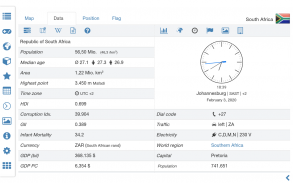
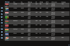
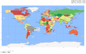
Atlas dunia, peta dunia, dan aplikasi pendidikan untuk geografi. Bendera, peta ikhtisar, dan data dasar tentang 260 negara dan wilayah di dunia. Peta politik dengan unit regional dan data ekonomi dan statistik negara yang komprehensif untuk semua negara Afrika.
• Bendera, peta ikhtisar, dan data dasar untuk lebih dari 250 negara dan wilayah di dunia
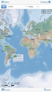
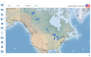
• Cari negara, kota besar, sungai, gunung, danau atau koordinat
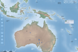
• Peta dunia politik dan benua yang interaktif
• Lapisan relief berarsir untuk peta dunia dan benua
• Tantangan kuis geografi untuk pembelajaran yang menyenangkan
• Perbandingan negara, favorit dan kalkulator jarak
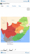
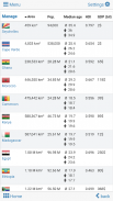
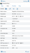
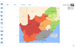
• Peta dan data komprehensif seluruh negara Afrika
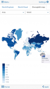
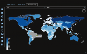
• Peta Choropleth: wilayah dan populasi
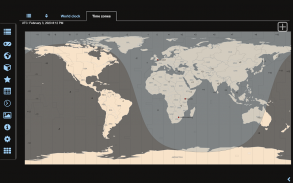
• Jam dunia dan kalkulator jarak
• Penjelajah dunia: negara terkecil, terbesar, ...
• Tidak diperlukan koneksi online
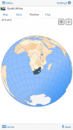
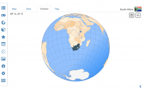
Jelajahi dunia berdasarkan peta offline dunia politik dan peta benua. Pelajari di mana setiap negara di dunia berada. Lihat posisinya yang disorot di globe digital. Buat tema warna favorit Anda atau pilih dari skema warna berbeda untuk tampilan peta.
Tahukah Anda bendera Zambia? Ya? Sempurna. Tahukah Anda juga di negara manakah letak Gunung Kilimanjaro? Kuis “Atlas dunia & peta dunia MxGeo Gratis” membantu Anda memperoleh literasi geografis dengan cara yang menyenangkan.
Pilih dari enam permainan tebak geo:
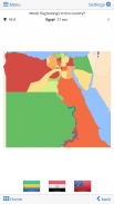
• Uji pengetahuan Anda tentang ibu kota Afrika
• Apakah Anda mengetahui kode negara ISO?
• Kenali bendera negara yang tepat berdasarkan garis besar peta
• Apakah Anda mengetahui domain tingkat teratas di setiap negara?
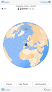
• Tebak negara yang disorot di dunia maya
• Tahukah Anda pegunungan di Afrika?
Aplikasi pembelajaran geo dan game edukasi yang menyenangkan untuk semua orang baik anak-anak, dewasa, manula, atau guru. Bersiaplah untuk kunjungan Anda berikutnya ke luar negeri sambil menikmati almanak dunia yang luar biasa ini termasuk zona waktu dan data statistik, seperti pertumbuhan populasi dan angka-angka penting lainnya. Atau persiapkan pelajaran geografi Anda berikutnya dengan peta dunia digital jenius ini. Jika tidak bepergian, atlas dunia kami memungkinkan Anda menjelajahi dunia hanya secara virtual.
Versi gratis mencakup data dan peta komprehensif untuk semua negara Afrika. Dapatkan “Atlas dunia & peta dunia MxGeo Pro” dengan data dan peta terperinci termasuk unit regional dan ibu kota untuk lebih dari 260 negara dan wilayah di dunia: Eropa, Asia, Amerika Utara, Afrika, Oseania, dan Amerika Selatan.
World atlas & world map MxGeo - Versi 9.5.3
(03-07-2025)
World atlas & world map MxGeo - Informasi APK
Versi APK: 9.5.3Paket: de.mediaz.mxapp.hpbgeodefreeVersi Terakhir dari World atlas & world map MxGeo
Versi lain


Aplikasi pada kategori yang sama


Anda juga mungkin suka...
Aplikasi pada kategori yang sama


